Menu
Our Office
-
The Zentral, word trade center, Dubai, UAE
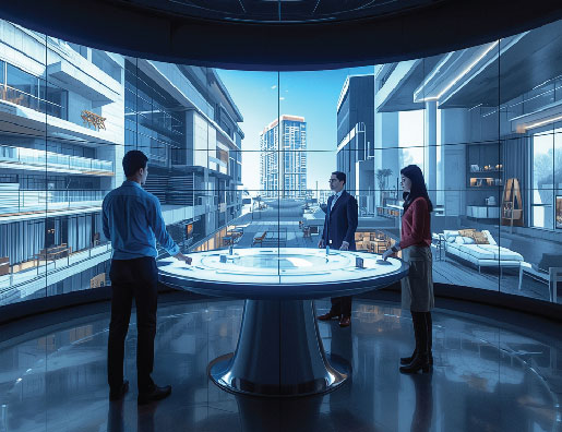
• Immersive 3D City Models
_ Users can navigate districts or full city models in 3D from both ground and aerial perspectives.
_ Planners can visualize real-world infrastructure, streets, and public spaces interactively.
_ Different zoning areas and city layers can be toggled for detailed analysis.
• Environmental Simulation & Analysis
_ Real-time simulation of sunlight, wind, and traffic patterns.
_ Assessment of environmental impact for sustainability and energy efficiency.
_ Helps optimize urban livability through scenario-based planning.
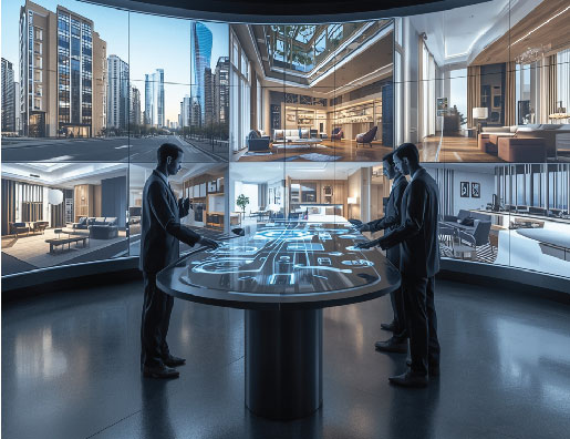
• Stakeholder Collaboration & Public Engagement
_ AR-enabled consultations allow citizens to visualize planned developments in their real-world context.
_ Interactive virtual environments enable seamless collaboration between urban planners, architects, and authorities.
_ Facilitates informed decision-making with real-time feedback from all stakeholders.
• Integration & Connectivity
_ Connects with GIS and Building Information Systems (BIS) for data-driven planning.
_ Centralized data management supports long-term urban development and planning insights.
• Traditional urban planning lacks interactive visualization of infrastructure and environmental factors.
• Difficulty in predicting environmental impacts and traffic patterns before construction.
• Limited public participation and stakeholder collaboration.
• Inefficient integration between planning data, visualization, and decision-making processes.
• Immersive Urban Visualization: Planners and citizens explore urban environments virtually for better understanding of scale and impact.
• Real-Time Environmental Simulation: Sunlight, wind, and traffic are simulated to optimize sustainability and livability.
• Enhanced Collaboration & Engagement: Stakeholders interact in real time and citizens can give feedback through AR consultations.
• Integrated Data Management: GIS and BIS connectivity creates a centralized, future-ready database for urban planning.
• Informed Decision-Making: Combines AR/3D visualization, environmental data, and stakeholder feedback to reduce errors and improve project outcomes.
Urban empowers planners, authorities, and citizens to make informed, interactive, and confident decisions regarding city development. By providing immersive 3D visualization, real-time simulations, and integrated stakeholder engagement, the platform enhances collaboration, reduces planning errors, and supports sustainable and data-driven urban growth.
WE ARE READY
TO TURN ANY OF YOUR IDEAS INTO REALITY.
2026 © Amitis Group. All rights reserved.